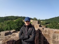
Mojdeh Safaei
| Since 2020 | Scientific assistant, chair of Landscape Ecology and Landscape Planning, Justus Liebig University Gießen |
| 2019- 2018 |
Research Stay at the Chair of Remote Sensing and Landscape Information Systems Albert- Ludwigs- University Freiburg, Germany |
| 2017-2016 |
Freelance Work (Project: Developing a holistic management plan of wetlands) Department of Environmental Protection, Tehran, Iran |
| 2017- 2010 |
Studies of Natural resources engineering, Rangeland and watershed management Department of Natural resources, Isfahan University of Technology, Iran |
- Application of optical remote sensing and GIS in landscape ecology
- Ecosystem health analysis
- Species distribution modeling
|
Using remote sensing to develop dynamic indicators of ecosystem health in times of global change: from forest drought to plant invasions
The proposed project consists of two thematically different topics. The first topic is to develop a first assessment of the status of forests in the Federal state of Hesse using dynamic habitat indicators (DHIs). DHIs present an opportunity to study geographic patterns of different phenological characteristics based on functionality indices. The second topic is the invasion by non-native plant species. Invasive species demonstrate a major threat to ecosystem services and biodiversity and ecosystem health. Invasive species can cause significant damages to human livelihood because they made some alternations in e.g. nutrient and water cycling, fire regimes, or energy budgets of native plant species and ecosystems. |
MP 178: Empirical Research Methods for Natural Research Analysis
MP 217: Remote sensing and GIS in Landscape ecology
- Safaei M , Jafari R, Datta P, Bashari H, Poither D, and Koch B, 2021. Spatial scale effect of Sentinel-2, Landsat OLI, and MODIS imagery in the assessment of landscape condition of Zagros Mountains. Geocarto International https://doi.org/10.1080/10106049.2021.1914745
- Safaei M , Bashari H, Mosadegi MR, and Jafari R, 2019. Assessing the impacts of land-use and land cover changes on soil functions using landscape function analysis and soil quality indicators in semi-arid natural ecosystems. CATENA. https://doi.org/10.1016/j.catena.2019.02.021
- Safaei M , Tarkesh M, Bashari H, and Basiri M. 2018. Modeling potential habitat of Astragalus verus Olivier for conservation decisions: A comparison of three correlative models. Flora - Morphology, Distribution, Functional Ecology of Plants. https://doi.org/10.1016/j.flora.2018.03.001
- Safaei M , Bashari H, Kleinebecker T, Fakheran S, Jafari, R and Große-Stoltenberg A. Linking Field-based assessments with remote sensing landscape pattern indices to map ecosystem health in semi-arid ecosystems. Submitted in the Landscape Ecology journal

