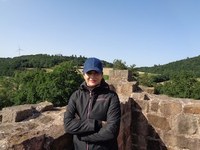
Mojdeh Safaei
| Seit 2020 |
Wissenschaftliche Mitarbeiterin an der Professur für Landschaftsökologie und Landschaftsplanung der Justus-Liebig-Universität Gießen |
| 2019- 2018 | Forschungsaufenthalt an der Professur für Fernerkundung und Landschaftsinformationssysteme, Albert-Ludwigs-Universität Freiburg |
| 2017-2016 | Freiberufliche Tätigkeit (Projekt: Entwicklung eines ganzheitlichen Managementplans für Feuchtgebiete), Umweltschutzabteilung, Teheran, Iran |
|
2017- 2010 |
Studium Bewirtschaftung natürlicher Ressourcen von Weideland Abteilung für natürliche Ressourcen, Technische Universität Isfahan, Iran |
- Fernerkundung und GIS in der Landschaftsökologie
- Ecosystem health analysis
- Species distribution modeling
DHI: Using remote sensing to develop dynamic indicators of ecosystem health in times of global change: from forest drought to plant invasions, Ziel des Promotionsvorhabens ist es, Früh-Indikatoren zur Beeinträchtigung von Ökosystemen im Hinblick auf Sustainable Development Goals aus Satellitendaten abzuleiten. Im Zeichen des Klimawandels sollen für Hessen negative Entwicklungen bedingt durch Trockenheit und invasive Pflanzenarten abgeleitet und prognostiziert werden. Ein Schwerpunkt wird auf erst seit kurzem verfügbare Satellitendaten zu Phänologie, Ökophysiologie und 3D-Vegetationsstruktur gesetzt.
Aliens: Alien species in a changing world - Detection, monitoring and prediction
MP 178: Empirical Research Methods for Natural Research Analysis
MP 217: Fernerkundung und GIS in der Landschaftsökologie
-
Safaei M , Kleinebecker T, Weis M, Große-Stoltenberg A (2024) Tracking effects of extreme drought on coniferous forests from space using Dynamic Habitat Indices. Heliyon 10: e27864 [ doi.org/10.1016/j.heliyon.2024.e27864 ]
-
Große-Stoltenberg A , Hanzl A, Safaei M , Kleinebecker T (2024) Once Common, Long in Decline: Dynamics of Traditional Orchards in a Central European Landscape. Land 13:1639. [ doi.org/10.3390/land13101639 ]
-
Safaei M , Kleinebecker T, Große-Stoltenberg A (2023) Potential of the satellite-based Dynamic Habitat Index (DHI) to capture changes in soil properties and drought conditions across Land Use/ Land Cover types. Geocarto International 38: 2292162 [ doi.org/10.1080/10106049.2023.2292162 ]
-
Safaei M , Bashari H, Kleinebecker T, Fakheran S, and Große-Stoltenberg A, 2022. Mapping terrestrial ecosystem health in drylands: comparison of field-based information with remotely sensed data at watershed level. Landscape ecology. https://doi.org/10.1007/s10980-022-01454-4
-
Safaei M , Jafari R, Datta P, Bashari H, Poither D, and Koch B, 2021. Spatial scale effect of Sentinel-2, Landsat OLI, and MODIS imagery in the assessment of landscape condition of Zagros Mountains. Geocarto International https://doi.org/10.1080/10106049.2021.1914745
-
Safaei M , Bashari H, Mosadegi MR, and Jafari R, 2019. Assessing the impacts of land-use and land cover changes on soil functions using landscape function analysis and soil quality indicators in semi-arid natural ecosystems. CATENA. https://doi.org/10.1016/j.catena.2019.02.021
-
Safaei M , Jafari R, Bashari H. et al. Mapping and monitoring the structure and function of rangeland ecosystems in central Zagros, Iran. Environmental Monitoring and Assessment 190, 662 (2018). DOI: 10.1007/s10661-018-7005-8
- Safaei M , Tarkesh M, Bashari H, and Basiri M. 2018. Modeling potential habitat of Astragalus verus Olivier for conservation decisions: A comparison of three correlative models. Flora - Morphology, Distribution, Functional Ecology of Plants. https://doi.org/10.1016/j.flora.2018.03.001

